GeoAI

Technical Track | 30 April 2026 | Hall - Tech Zone 2

(Open for Visitors)


Agenda

1030 - 1130
Session 1: Geospatial Data Quality, Trust & Human-Centred Decision Intelligence with Conversational AI
Ervin Ruci
Ervin Ruci

Founder
Geolytica INC.
Canada

Ryan Bank
Ryan Bank

Global Managing Director
Vexcel Data Program
Austria

Florian Twaroch
Florian Twaroch

Strategy and Governance
Federal Office of Metrology and Surveying
Austria

Iwona Kaczmarek
Iwona Kaczmarek

Associate Professor
Uniwersytet Przyrodniczy we Wroctawiu
Poland

1130 - 1330
Networking Coffee Break Followed by Lunch
1330 - 1500
Session 2: GeoAI in Action: Transforming Environment, Climate & Multi-Sector Analytics
Adam Iwaniak
Adam Iwaniak

CEO
The Wroclaw Institute of Spatial Information and Artificial Intelligence
Poland

Ramesh Kajrolkar
Ramesh Kajrolkar

COO
AI Infrasolutions
The Netherlands

Kwonho Lee
Kwonho Lee

Professor
Gangneung-Wonju National University
Korea-South

Yoann Mira
Yoann Mira

Solutions Engineer
Novel-T
Switzerland

Sergey Sukhanov
Sergey Sukhanov

Managing Director
FlyPix AI
Germany

Rami Alouta
Rami Alouta

Senior Solutions Engineer
Esri
The Netherlands

1500 - 1600
Networking Coffee Break
1600 - 1730
Session 3: From Earth Observation to Action: GeoAI for End-User Empowerment
Marianne Slamich
Marianne Slamich

CMO
Pointr
UK

Gennadii Donchyts
Gennadii Donchyts

Staff Engineer, Geo Enterprise Sales
Google
The Netherlands

Patrick Stevenson
Patrick Stevenson

Chief Product Officer
Blue Marble Geographics
USA

Hans Viehmann
Hans Viehmann

Director of Product Management - Spatial and Graph Technologies
Oracle
Greater Hamberg Area

Hamed Alemohammad
Hamed Alemohammad

Geospatial Director and Professor
Clark University
USA

Overview

The Geospatial World Forum 2026 will feature a 90-minute technology program on GeoAI, highlighting its transformative impact across industries like AEC (Architecture, Engineering, and Construction), Geospatial Knowledge Infrastructure, Utilities & Network, Defence & Intelligence, Capacity Development, Space2Earth, Climate Resilience and Disaster Management, Hydrospatial Infrastructure and Blue Economy, Agriculture, Land & Property.

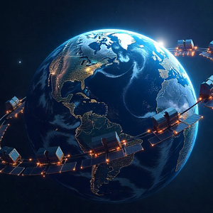
GeoAI is the fusion of geospatial technologies and artificial intelligence that is transforming how we analyze, predict, and manage our world. By combining satellite imagery, sensor data, and spatial analytics with machine learning, GeoAI enables automated mapping, change detection, and predictive modeling at unprecedented speed and scale. In the geospatial sector, it advances urban growth analysis, infrastructure monitoring, and environmental assessment, while in the space domain, it enhances satellite image interpretation, orbital analytics, and planetary exploration. GeoAI’s applications span smart cities, agriculture, climate resilience, transportation, defense, energy, and environmental conservation, providing actionable intelligence for sustainable development. Despite its promise, challenges such as data quality, algorithm bias, transparency, and data privacy remain.

At GWF 2026, this track will highlight emerging opportunities from edge AI and cloud-based analytics to integration with digital twins and spatial computing and showcasing how GeoAI is driving faster, smarter, and more sustainable spatial intelligence across Earth and beyond.