


Overview
The Geospatial World Forum 2026 will feature a 90-minute technology program on HD Mapping and Autonomy, showcasing its transformative impact across a wide range of industries, including AEC(Architecture, Engineering, and Construction), Defence & Intelligence, Capacity Development, Space2Earth, Climate Resilience and Disaster Management, Hydrospatial Infrastructure and Blue Economy, Agriculture, and beyond.
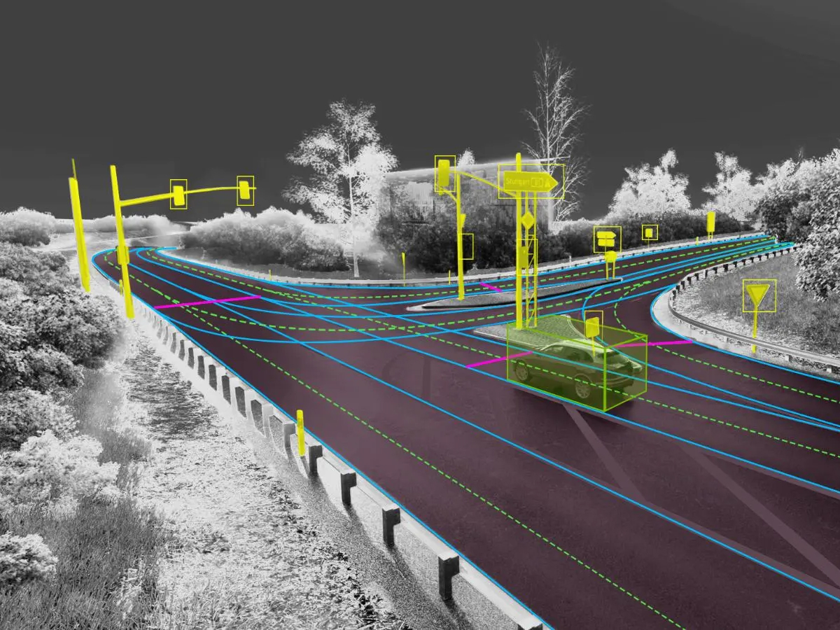
High-Definition (HD) Mapping and autonomous technologies are transforming how we perceive, navigate, and interact with both terrestrial and extraterrestrial environments. As precision-driven digital representations of the physical world, HD maps integrate multi-sensor data, including LiDAR, radar, photogrammetry, GNSS, and Earth observation satellites to deliver centimeter-level accuracy essential for intelligent mobility, infrastructure management, and advanced decision-making. In the geospatial and space sectors, HD mapping enables automation, situational awareness, and predictive modeling, powering applications from autonomous vehicles and drones to lunar and planetary navigation. The technology offers immense potential across transportation, smart cities, defense, agriculture, disaster management, space exploration, and energy sectors. It supports advancements such as digital twins, precision farming, predictive maintenance, and resilient infrastructure. However, key challenges include data accuracy, interoperability, high acquisition costs, real-time map updates, and regulatory concerns related to privacy and safety.
Emerging opportunities are equally promising and include the fusion of geospatial intelligence with AI and machine learning, the integration of edge computing and next-generation satellite navigation systems for real-time positioning, and cross-sector collaboration between geospatial, automotive, and aerospace domains. At GWF 2026, this technical track will explore how HD Mapping and autonomy are driving the next frontier of connectivity, resilience, and spatial intelligence for a smarter, more sustainable world.