Data Science
Theme: Integrated Spatial Analytics for Advanced Applications
Concept Note
The Geospatial World Forum 2025 will feature a 120-minute technology program on Data Science, highlighting its transformative impact across industries.
Data science and geospatial technology represent a powerful convergence, unlocking insights for decision-making across industries. This technical session will highlight advancements in AI-driven geospatial analytics, including automation, AI-powered real-time insights and integrating multi-source data for enhanced spatial insights. Having rich data, augmenting insights from integrated sources of information, leveraging advanced algorithms, machine learning, and big data analytics has levelled up Data Science which is now facilitating understanding of patterns and trends.
The Technical Session will bring together experts and innovators to explore the transformative role of geospatial data, AI, and digital technologies in addressing global challenges. Discussions will delve into large-scale applications, from Geospatial AI & Computer Vision, Urban Analytics & Mobility, Spatial Data Science & Modelling of hazards, building data observatories to Data Infrastructure & Governance and more.
By 2025, these technologies will play a key role in transforming industries and driving efficiency and sustainability across sectors.
Speakers

Moderator
Jennifer Marlon
Executive Director
Yale Center for Geospatial Solutions
USA
Andy Bell is Senior Vice President of Global Data Product Management at Precisely, responsible for the global data portfolio. Andy has accumulated a wealth of experience over 30 years in data and analytics, leading teams involved in product development, data science and analytics and GIS. He has previously worked for GlaxoSmithKline and CallCredit instigating a number of innovative data developments as well as new ways of applying data and insight to new market problems. Andy is currently driving the data strategy at Precisely, identifying and developing new and innovative data products.

As the Data Science Team Lead of the Gesopatial data team for Geotab, Jorge Gonzalez brings eight years of expertise in vehicle data analytics. With a foundation as a Telecommunications Engineer and a Masters in Science in Artificial Intelligence, Jorge is adept at navigating the complexities of data quality and scarcity issues and helping clients interpret vast volumes of data effectively. With Geotab data, Jorge collaborated in safety analytics, GPS and cell coverage, engine status data availability and vehicle electrification among others.

Daniel is an experienced data scientist with a master's in signal theory (telecommunications). He accounts for 10 years of professional experience in different IT fields, working on companies ranging from impactful seed-phase startups like Ketekelo to global companies like BASF, and now as part of the Geospatial team at Geotab. Daniel's main focus at Geotab is Geospatial ML modeling, but he also takes care of the whole product lifecycle of a good portion of Geotab's geospatial product backbone.
Mohamed Kasim Khan
PhD Scholar
Indian Institute of Technology Bombay
India

Javier de la Torre
Founder and Chief Strategy Officer
CARTO
Spain
Rami Alouta is a Senior Solutions Engineer at Esri, based in the Rotterdam office, with a strong focus on advancing AI in the geospatial industry. Specializing in both Generative AI (GenAI) and GeoAI, Rami leverages cutting-edge technologies to deliver innovative solutions across diverse sectors, including Mapping Agencies, United Nations Non-Profit Organizations, and the humanitarian community.
With extensive experience in Python development and ArcGIS Enterprise, Rami excels in designing, configuring, and deploying scalable geospatial systems. His expertise includes automation workflows, ArcGIS Python libraries, and building well-architected solutions that drive efficiency and value for clients. Recognized as a Subject Matter Expert (SME), Rami is known for his ability to bridge the gap between AI innovation and practical geospatial applications.Rami holds a degree in Landscape Architecture from the American University of Beirut, which provides him with a unique perspective on the intersection of technology, design, and the environment.
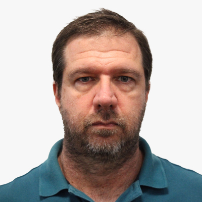
Rodney Borrego Acevedo
Research Fellow
Earth Observation Research Centre, The University of Queensland
Australia
Dr. Rodney Borrego Acevedo is a remote sensing specialist with fifteen years of experience in coral reef habitat and terrestrial mapping. He holds a PhD in Mapping Science from The University of Queensland, where he currently serves as a Research Fellow at the Earth Observation Research Centre. His current work focuses on mapping mid-shelf and offshore reefs in the Great Barrier Reef, Australia.
Rodney has held key scientific and technical roles in both academia and government, including with the Allen Coral Atlas and the Queensland Department of Environment and Science, contributing to large-scale habitat and land use mapping initiatives. His expertise spans reef geomorphology, satellite remote sensing, and ecosystem monitoring, supported by field and spatial data analysis.
Originally trained as a biologist, Rodney has worked across the Caribbean, South America, and Australia, blending research with applied conservation. His work has directly supported marine park management, sustainable tourism, and fisheries policy. He remains committed to advancing environmental stewardship through data-driven science.
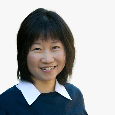
Jane Law
Associate Professor
University of Waterloo
Canada

Peter Baumann, a distinguished figure in the field of Computer Science, is a Professor at Jacobs University Bremen and the visionary CEO & founder of rasdaman GmbH, based in Bremen. Renowned for pioneering Array Databases, his contributions span data models, query languages, storage optimization, and applications in diverse fields such as earth, space, and life sciences. Actively involved in standardization efforts for spatio-temporal geo services (OGC, INSPIRE, ISO) and Array SQL (ISO), Dr. Baumann's career balances scientific innovation with practical industrial applications. As the principal architect of the APRIL object-oriented database system during his PhD at Technical University Darmstadt, he laid the foundation for his groundbreaking work in large, multi-dimensional raster datasets and the development of rasdaman, the world's first operational Array Database System. Dr. Baumann's achievements extend to patenting his concepts globally and leading influential working groups in OGC, showcasing his commitment to advancing the field.

Rencai Dong
Professor - State Key Laboratory of Urban and Regional Ecology
University of Beijing
China
Abdulrahman Ibrahim
Chief Data and Innovation Officer
Madinah Region Development Authority
Saudi Arabia
