
 Sanchita Biswas
 Oct 26, 2026
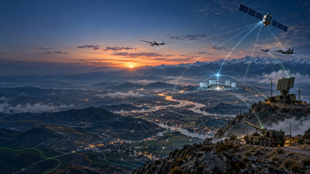
How long-range weapons, precision guided munitions and better targeting data are reshaping modern combat.
A weapon’s range may be measured in kilometres, but a strike begins with a more basic question: where is the target, and what is happening around it?
Standoff warfare means engaging a target from a distance while keeping own aircraft, artillery crew or launch platform farther from its immediate defences. Typically, can involve missiles, guided bombs, artillery and rockets. But range alone does not make a strike effective. Forces need to locate and verify the target, select the appropriate weapon, communicate securely and assess the result. “Standoff” is established military terminology, not a new doctrine. The U.S. Air Force describes standoff weapons as weapons launched from outside the combat area.
Operation Sindoor brought this approach into sharp focus. It also highlighted the role of geospatial intelligence: the maps, imagery and location data that help forces understand the terrain, track activity and make decisions. Standoff warfare is therefore not just about longer-range vectors. It is about connecting information to action.
Standoff warfare is not one weapon but several, each serving a different mission.
Operation Sindoor brought a broader combination of long-range weapons, precision-guided munitions and layered air defence into the same operational picture. Indian briefings described precision strikes and defensive operations against drone and missile threats. Public reporting also detailed the use of air-launched weapons, loitering munitions and precision-guided artillery.
OPs Sindoor confirmed why offensive and defensive capabilities need to be connected. Aircraft and artillery may strike targets from a distance, while air-defence systems protect forces and infrastructure from retaliation. Geospatial information can help commanders understand where threats are occurring, how they relate to protected sites and where units need to be positioned.
The operation also points to the demands of readiness: mobile platforms, trained personnel, secure communications, ammunition stocks and maintenance all matter. Geospatial data is most valuable when it reaches the right people and in time.
To make standoff warfare reliable, India needs to connect weapons with accurate geospatial information and the people who can act on it. That means keeping maps, imagery and target-location data current, securing communication between sensors, command centres and units and connecting aircraft, air defence, artillery and rocket systems. It also means training personnel to verify information and assess results, while maintaining mobile platforms, ammunition stocks, repair capacity and domestic supply.
That integration is also a race against an adversary’s decision cycle. Chief of Defence Staff General N. S. Raja Subramani warned that “there is increasingly no safer rear,” as long-range sensing and weapons blur the old distinction between front and rear. He described how quickly a threat can move from detection to action:
“A sensor is able to see you, an algorithm is able to classify, a network can transmit.” For India’s standoff capability, that makes accurate geospatial intelligence and resilient communications essential: they must get verified target information to commanders and the right response system in time to act.
Standoff warfare does not replace the soldier. It changes the demands placed on the soldier: operators must interpret information, coordinate across systems and make sound decisions under pressure.
A strike may take minutes; preparing for it can take far longer. Intelligence, target validation, planning and training all shape what happens before launch. The missile is the final link in that chain. For India, the lasting advantage will come from combining reach with accurate geospatial information, coordinated forces and the readiness to sustain operations.
At GeoSmart India 2026, the Defence & Intelligence Summit will bring this conversation into focus: how sovereign geospatial capabilities can help connect sensors, commanders and response systems across the battlefield.
Because the value of a weapon’s range depends on the quality of the information guiding it. Geospatial intelligence helps turn data into decisions and decisions into coordinated action.The future advantage will not come from seeing farther alone. It will come from turning spatial intelligence into timely action.