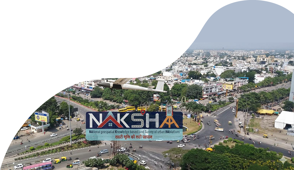
National Symposium on

Landstack & NAKSHA –
National Geospatial Knowledge-based Land Survey of Urban Habitations

3 December 2025 | Hall No - Audi 1

Program Agenda

Wednesday, 3rd December

0900 - 0930
Registration
0930 - 1045
Inaugural Session
Sanjay Kumar

Welcome Address

Sanjay Kumar

Chief Executive Officer
Geospatial World

Kunal Satyarthi

Symposium Overview

Kunal Satyarthi

Joint Secretary
Department of Land Records Government of India

Manoj Joshi, IAS

Leadership Address

Manoj Joshi, IAS

Secretary
Department of Land Resources, Government of India

Shyam Kumar

Vote of Thanks

Shyam Kumar

Director
Department of Land Resources, Government of India

1045 - 1130
Session 1: NAKSHA Review

Session Highlight

Session brief & deliberation points: A comprehensive review of the pilot programme, its objectives, coverage across 150+ cities, and early outcomes in modernizing urban land records.
  • Review the progress of NAKSHA in all States/UTs
  • Challenges so far faced in implementation
  • Importance of integration of geospatial technologies for accurate land mapping and data visualization
  • Successful models of public-private partnerships and the role of technology companies in developing and implementing innovative solutions
Kunal Satyarthi

Kunal Satyarthi

Joint Secretary
Department of Land Records Government of India

1130 - 1150
Tea & Coffee Break
1150 - 1245
Session 2: Aerial Flying & Feature Extraction-Learnings from NAKSHA

Session Highlight

Session deliberation points:
  • How does aerial photography modernize urban cadastres by improving positional accuracy and ensuring transparent property depiction?
  • What methods does Survey of India use to ensure high ORI and feature-extraction accuracy, and what challenges arise when aligning them with ground truth and legacy cadastral maps?
  • How is aerial data accuracy maintained in dense urban areas despite shadows, reflections, and occlusions?
  • How do LiDAR and oblique imagery complement each other in creating 3D city models, and what unique value does each provide?
  • How mature are AI/ML techniques for extracting parcels, building footprints, and urban features where no common identifiers exist?
  • Is AI automation in national survey platforms a strategic advantage or a complexity risk, given scale and accuracy needs?
  • How can cloud limitations and fragmented microservices be addressed to maintain performance and security at statewide scale?
  • What architectural improvements are needed to make WebGIS platforms fully seamless for feature extraction and Ur-Pro Card generation?
  • How do privacy rules, no-fly zones, and operational restrictions shape aerial survey planning and execution in urban areas?
  • What common errors occur in large-scale urban aerial surveys, and which best practices most effectively reduce them?
  • What validation frameworks are required to reconcile high-resolution aerial outputs with ground survey realities in complex urban settings?
  • When datasets lack unique identifiers, which AI or computational approaches best support reliable land data integration?
S.K. Sinha

Chair

S.K. Sinha

Additional Surveyor General
Survey of India

Shivangi S Somvanshi

Moderator

Dr Shivangi S Somvanshi

Centre Head
Centre for Applied Geomatics (CAG), CEPT University

Mandvi Misra

DoLR Moderator

Dr Mandvi Misra


GIS Technical Expert

Misal Roshan Shrivastava

Misal Roshan Shrivastava

Superintending Surveyor
Survey of India

B. Venkateswar Reddy

B. Venkateswar Reddy

Director
Aarvee Associates

Saurabh Rai

Saurabh Rai

Chief Strategy & Growth Officer
NeoGeo Technologies

Sundar Raj

Sundar Raj

Delivery Head
LTI Mindtree

Surendra Nath Das

Surendra Nath Das

Chief Executive Officer
Mapex

Atanu Sinha

Atanu Sinha

Chief Executive Officer
Garuda UAV

1245 - 1330
Session 3: NAKSHA Ground Truthing, Interoperability and Data Maintenance in Urban Areas

Session Highlight

Session deliberation points:
  • Which advanced survey methods and geospatial technologies are improving the precision and reliability of ground-based land surveys?
  • How can land parcel boundary delineation and land attribute capture be enhanced to boost transparency, accuracy and accountability in land governance?
  • What key challenges hinder interoperability when merging land datasets from municipalities, revenue agencies and private entities and how can these be resolved?
  • Which data standards, institutional protocols and technical frameworks are required to build a unified, interoperable architecture for seamless land record exchange and updates across departments?
  • Which emerging technologies such as AI analytics, blockchain, 3D mapping and cloud geospatial platforms will most improve efficiency, accuracy and citizen centric land administration?
P. Amudha

Chair

P. Amudha

Additional Chief Secretary
Revenue Department, Government of Tamil Nadu

Vinod Mishra

Moderator

Vinod Mishra

Vice President
MapmyIndia

Ashwani Alfred

DoLR Moderator

Ashwani Alfred

Manager Geospatial Technology

Krishna Mohan Uppu

Krishna Mohan Uppu

Secretary (Revenue)
Government of Puducherry

J Manjunath

J Manjunath

Commissioner
Survey Settlement and Land Records (SSLR), Government of Karnataka

R.J. Vidyullatha

R.J. Vidyullatha

Director
Town Country Planning, Government of Andhra Pradesh

Yash Pal

Yash Pal

Director
Land Records, Government of Haryana

Ranjana Rajguru

Ranjana Rajguru

Commissioner cum Secretary
Revenue Department, Government of Uttarakhand

1330 - 1430
Lunch Break
1430 - 1515
Session 4: Land Stack: Building the Future of India's Digital Land Ecosystem

Session Highlight

  • What key base layers should form the core of a national Landstack-cadastral boundaries, ownership records, utilities, imagery, or others?
  • What are the major challenges in integrating cadastral maps, geospatial data and administrative records into a unified Landstack, and how can they be resolved?
  • What is the current readiness of utility agencies to provide accurate, real-time data and what steps are needed to onboard them into the Landstack?
  • Is a single national platform preferable, or should India adopt a federated Landstack where States retain autonomy under common standards?
  • What specific benefit such as reduced disputes, faster services, better planning, or improved credit and taxation can the Landstack deliver, and in what timeframe?
S. Chockalingam

Chair

S. Chockalingam

Chief Electoral Officer
Government of Maharashtra

Sanjay Kumar

Moderator

Sanjay Kumar

Chief Executive Officer
Geospatial World

Dhawal Trivedi

DoLR Moderator

Dhawal Trivedi

Technical Documentation Expert

J Manjunath

J Manjunath

Commissioner
Survey Settlement and Land Records (SSLR), Government of Karnataka

Sultan Singh

Dr Sultan Singh

Director & Chief Scientist
Haryana Space Applications Centre (HARSAC)

Deepak Jacob

Deepak Jacob

Director
Survey & Settlement, Government of Tamil Nadu

Zaffar Sadiq Mohamed-Ghouse

Prof (Dr) Zaffar Sadiq Mohamed-Ghouse

Vice President and Director-Advisory & Innovation
Woolpert

Samarth Hans

Samarth Hans

Director - Projects
Geospatial World

J.K Jain

J.K Jain

Expert Land Administration
Chandigarh

1515 - 1545
Tea & Coffee Break
1545 - 1645
Session 5: End-to-End Demonstration of WebGIS Platform & Cloud Services

Session Highlight

Session deliberation points:
  • How do limited cloud facilities cause performance bottlenecks?
  • What is the cloud strategy for scaling, ensuring data security, DR readiness, and maintaining high performance for statewide usage?
  • How can a lack of technology in a cloud environment affects the management of microservices?
  • How can the portal be made fully end-to-end and seamless for generating Ur-Pro Cards?
  • How can automated validation impact operations in no-network and low-network areas?
  • Is integrating AI automation into the portal a curse or a blessing?
  • How does the WebGIS/mobile app manage low network availability, inaccurate GPS points, and dense property clusters during field operations?
Deepak Jacob

Chair

Deepak Jacob

Director
Survey & Settlement, Government of Tamil Nadu

Snehashish Misra

Moderator

Snehashish Misra

Associate Professor
CRS-LBSNAA

Deepti Parihar

DoLR Moderator

Deepti Parihar

Data Management & Cloud Solutions Expert

Sandeep Goyal

Dr Sandeep Goyal

Executive Director
MPSEDC, Government of Madhya Pradesh

Krishna Rao TVB

Krishna Rao TVB

Vice President - Presales
Esri India

Koduri Venkatesh

Koduri Venkatesh

Project Manager
Dream Step Software Innovation Pvt. Ltd.

Gokhul Praveen

Gokhul Praveen

GIS Team Lead
Government of Karnataka

Pradeep Kumar

Pradeep Kumar

Manager
SPMU, Government of Maharashtra

N Prakash Ranjan Mahanta

N Prakash Ranjan Mahanta

Cloud - CSD HoD
National Government Cloud

1645 - 1730
Session 6: NAKSHA: Legal Framework

Session Highlight

Session deliberation points:
  • How to align Rules/ SOPs/ Manuals/ Instructions of the States and UTs to successfully implement NAKSHA?
  • How to expeditiously align Rules/ SOPs/ Manuals/ Instructions of the States and UTs for Surveys and re-Surveys of lands in Urban areas with use advanced surveying equipment?
  • What alignments are required to formally integrate private surveyors in the survey process to tide over the challenge of shortage of manpower for survey work?
  • How can the States and UTs ensure that the existing ownership formats align with the UrPro cards proposed by DoLR (with modifications, if any)?
  • Future of UrPro Card as a single trusted digital property document that can empower citizens through secure mortgages, effortless transfers, and seamless integration across registration, mutation, property tax, and building permission systems.
NK Sudhansu

Chair

NK Sudhansu

Director General
YASHADA, Government of Maharashtra

Deepika Jha

Moderator

Deepika Jha

Consultant
IIHS, Bengaluru

Niyati Patwardhan

DoLR Moderator

Niyati Patwardhan

Legal Advisor

J Manjunath

J Manjunath

Commissioner
Survey Settlement and Land Records (SSLR), Government of Karnataka

Kailash Karthik.N, IAS

Kailash Karthik.N, IAS

Inspector General of Registration and, Director- Land Records
Government of Assam

Arpit Mehta

Arpit Mehta

Assistant Director
Revenue Department, Government of Madhya Pradesh

Palavi Mishra

Palavi Mishra

Assistance Settlement Officer
Government of Bihar

Rakhee Singh

Rakhee Singh

Additional Director Land Records
Himachal Pradesh

Chandrakant. B. Shetkar

Chandrakant. B. Shetkar

Director
Directorate of Settlement and Land Records, Goa

1730 - 1830
Session 7: Symposium Wrap-up: From Pilot to National Rollout
Kunal Satyarthi

Symposium Outcomes

Kunal Satyarthi

Joint Secretary
Department of Land Records Government of India

Manoj Joshi, IAS

Address

Manoj Joshi, IAS

Secretary
Department of Land Resources, Government of India

Shyam Kumar

Vote of Thanks

Shyam Kumar

Director
Department of Land Resources, Government of India

1830 - 1930
Exhibition and Technology Interaction with Evening Reception in Exhibition Hall