GKI Training (Pre-conference)
27-28 October 2025
Evolving Role of National Mapping Agencies – Transitioning to Geospatial Knowledge Infrastructure
Training Outline
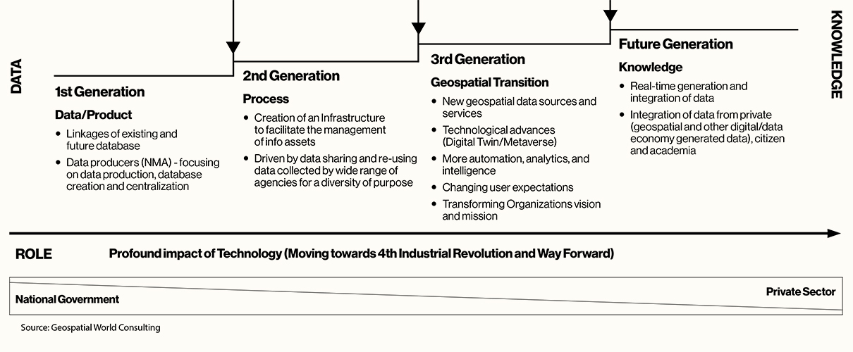
The global geospatial ecosystem is evolving from traditional Spatial Data Infrastructures (SDIs) to the advanced Geospatial Knowledge Infrastructure (GKI), which integrates data, technologies, and applications within a broader digital framework. GKI has emerged as a visionary framework to harness the full potential of geospatial data and applications, enabling smarter, more efficient, and more sustainable decision-making processes. The GKI Training Program aids this shift by equipping stakeholders from government bodies, national mapping agencies, the geospatial industry, academia, and the private sector with the tools and knowledge to build and manage geospatial knowledge infrastructures that are adaptive, resilient, and inclusive. In the Middle East, the adoption of GKI is vital for the region’s vision-driven transformation, empowering nations to unlock new opportunities in digitalization, economic diversification, and infrastructure advancement.
Learning Outcomes
- Comprehensive Understanding of the GKI Framework
- Ability to Conduct Socio-Economic Impact Assessments of GKI
- Proficiency in Utilizing 4IR Technologies and Geospatial Platforms
- Strategic Approach to Multi- Stakeholder Partnerships and Business Models
- Practical Application of GKI in Sectoral Workflows
GKI Partners