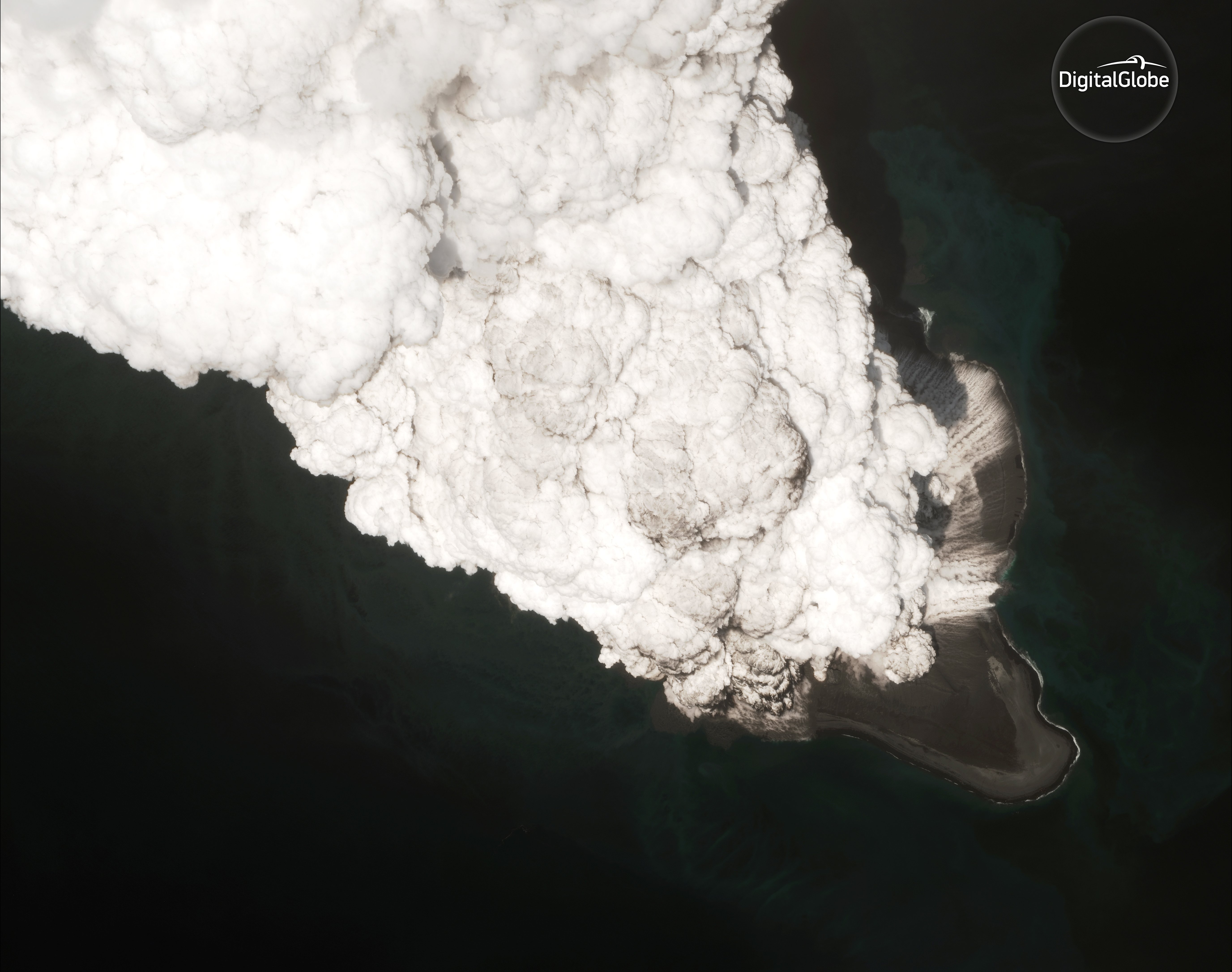
On Sunday, May 28, 2017, the Bogoslof Volcano in Alaska’s Aleutian islands erupted, sending a plume of ash upwards of 35,000 feet into the air. And now, DigitalGlobe, the Colorado-based satellite imagery company, has published the before, after, and in the midst eruption images of the local area.
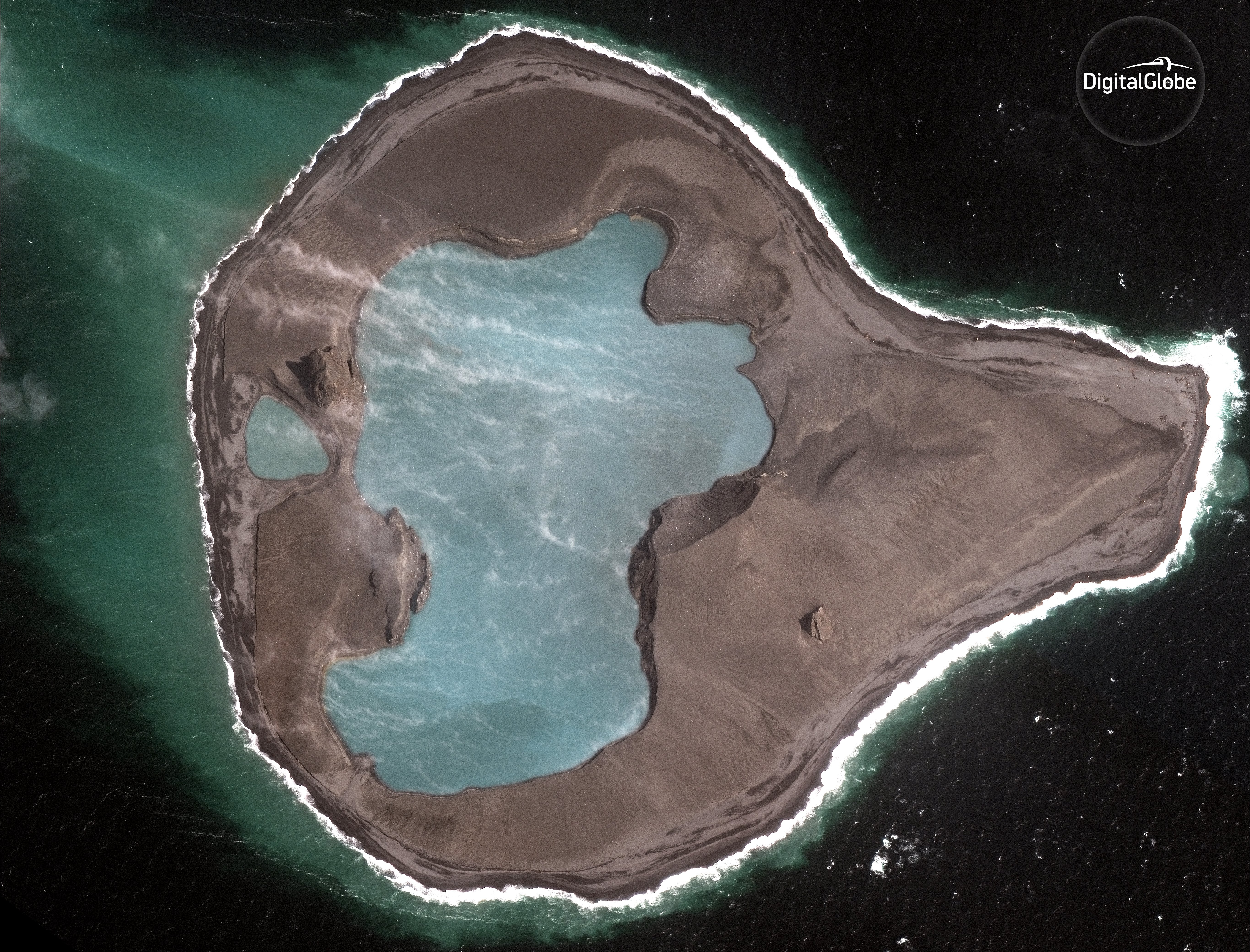
Analysis of before-and-after imagery clearly demonstrates the effect of the eruption on the size and shape of Bogoslof Island. Furthermore, the unmatched resolution of DigitalGlobe’s imagery is such that the company’s satellites were able to capture probable herd of fur seals on the shores of the island ahead of the eruption.
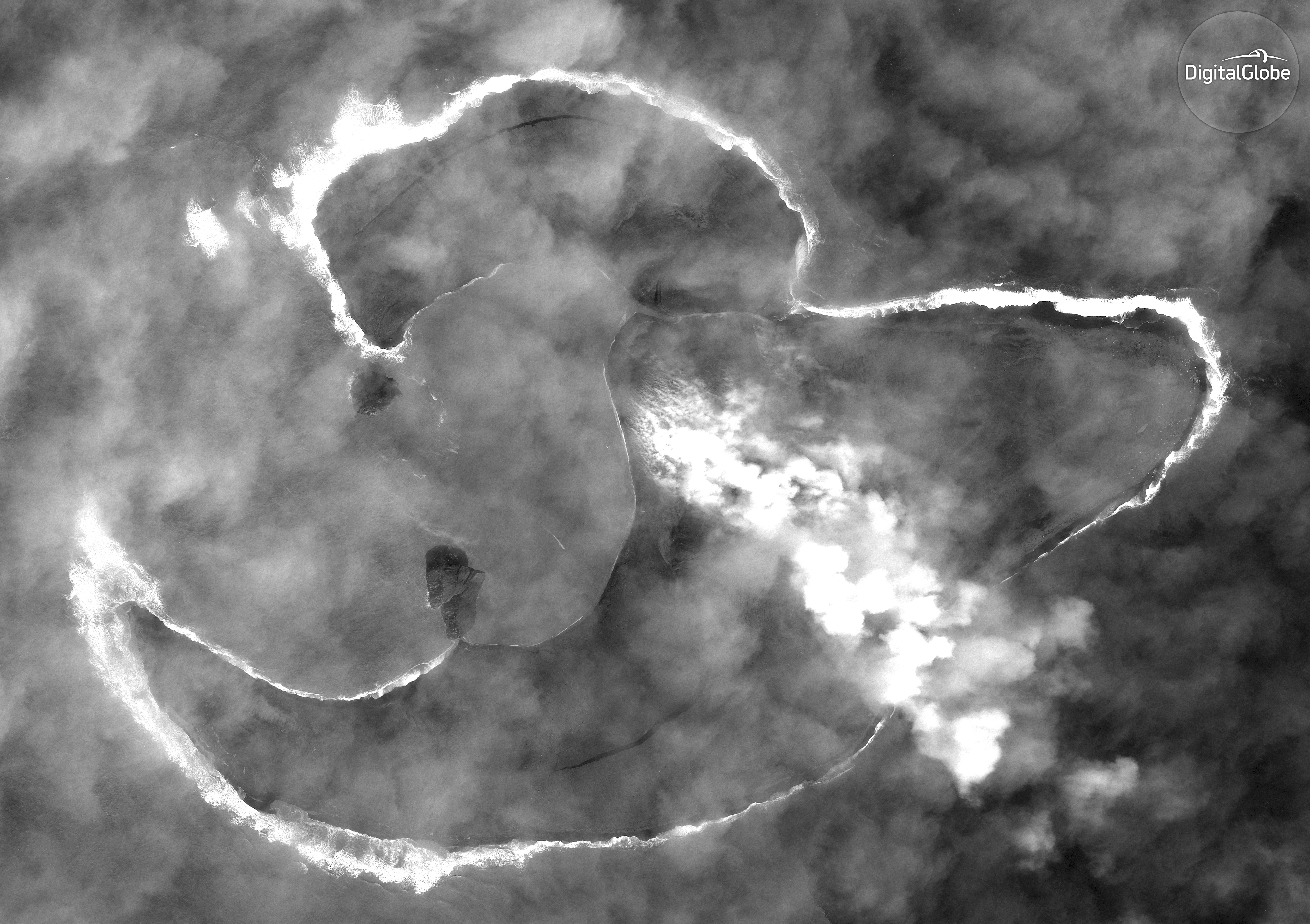
1May 11, 2017: Pre-eruption
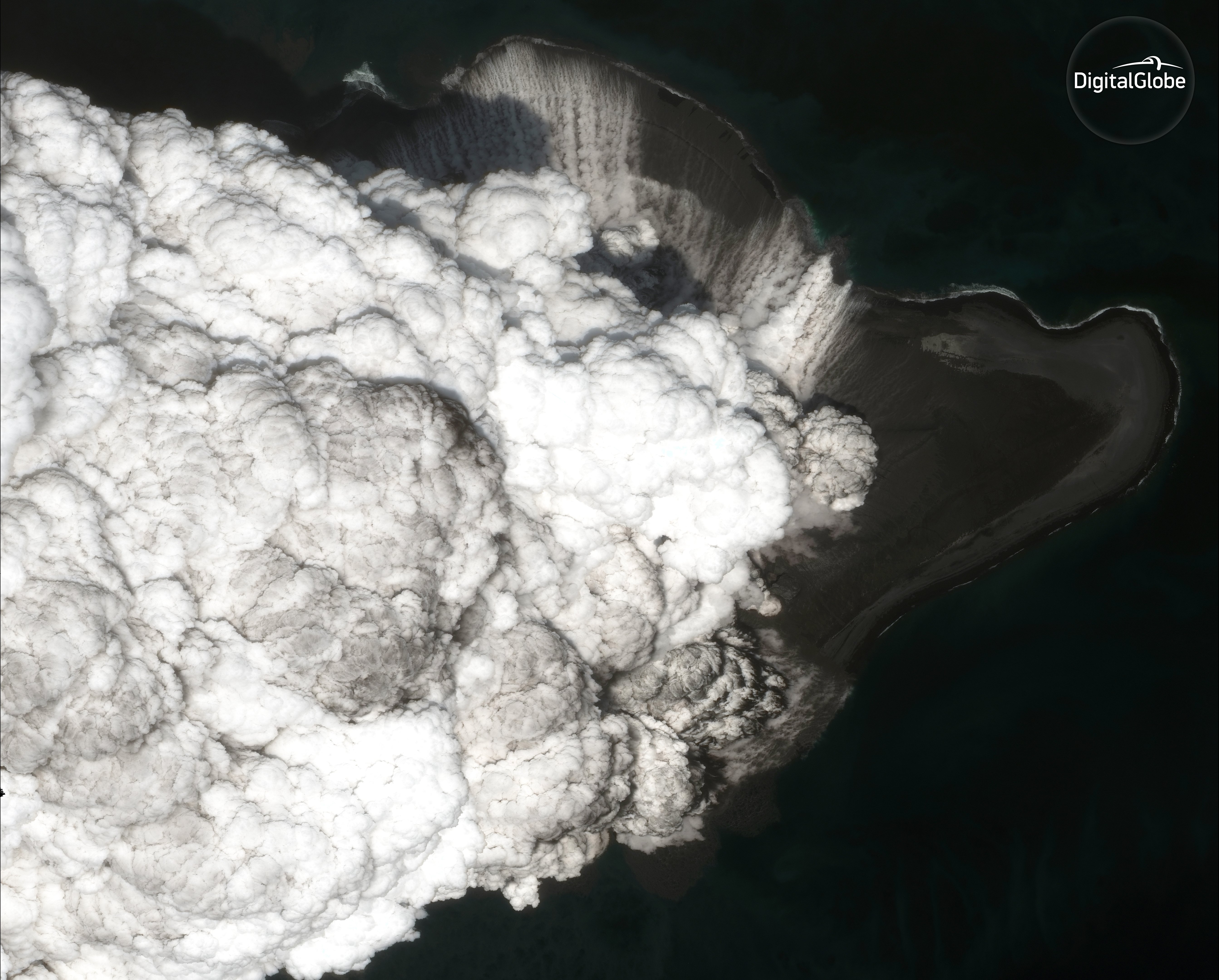
2May 28, 2017: During Eruption
3May 28, 2017: During Eruption
4May 28, 2017: Eruption Overview

5June 5, 2017: After Eruption