GW CONSULTING
GW EVENTS
GW MEDIA
ABOUT US
Search
Login
Logout
My Profile
Subscribe/Trial
Prime Stories
Special Features
Technology & Innovation
Business & Industry Trends
India
Interview
Opinion
Case Study
AEC
Business Intelligence
National Mapping
Sustainable Development
Agriculture
Defense & Security
Video
Podcast
Prime Stories
Special Features
Technology & Innovation
Business & Industry Trends
India
Interview
Opinion
Case Study
AEC
Business Intelligence
National Mapping
Sustainable Development
Agriculture
Defense & Security
Video
Podcast
GIS
GNSS
EOS
LiDAR
Location & BI
AEC
Autonomous
Sustainable Development
More
News
Articles
Blogs
Hall of Fame
Videos
Events
Newsletter
GIS
GNSS
EOS
LiDAR
Location & BI
AEC
Autonomous
Sustainable Development
More
News
Articles
Blogs
Hall of Fame
Videos
Events
Newsletter
Home
Geospatial Applications
Archaeology
Page 2
Latest
Latest
Featured posts
Most popular
7 days popular
By review score
Random
Archaeology
Chinese scientists use remote sensing to digitize the Great Wall
News Desk
-
03/22/2017
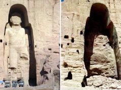
Afghanistan’s Bamiyan Buddhas to be reconstructed using laser scanning, 3D printing
News Desk
-
01/10/2017
Satellite imagery helps NASA unearth ancient lost city in Oklahoma
News Desk
-
12/01/2016
Researchers found new monumental platform in Jordan through remote sensing
News Desk
-
06/10/2016
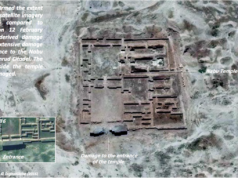
Satellite images show ancient Iraq temple destroyed
News Desk
-
06/09/2016
Scanning technique creates 3D map of archeological site
Geospatial World
-
07/24/2013
North Dakota University to map historical battle site using GIS
Geospatial World
-
07/15/2013
Monitoring archaeological sites with remote sensing & LiDAR
Carlos Eduardo Thompson Alves de Souza
-
06/17/2013
GPS survey equipment helping to uncover lost village
Geospatial World
-
06/07/2013
Iran completes first phase of mapping of archaeological sites
Geospatial World
-
03/06/2013
LiDAR technology reveals hidden archaeological site
Geospatial World
-
02/26/2013
New 3D mapping technology to preserve delicate structures
Geospatial World
-
12/26/2012
RS technology can find hidden archaeological sites: Research
Geospatial World
-
12/17/2012
ASI to use satellite mapping to protect monuments
Geospatial World
-
11/21/2012
Indian state to map heritage sites using g-tech
Geospatial World
-
08/07/2012
On-floor area based approach for heritage conservation and management
Geospatial World
-
09/26/2011
Standardization of Geomatics Applications in Cultural Heritage
Geospatial World
-
09/01/2009
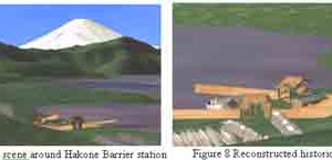
Visualization of historical spot around Hakone Barrier station using efficient city...
Geospatial World
-
09/01/2009
Potential of sunlight simulation to support conservation of Bayon archeological site
Geospatial World
-
09/01/2009
Ancyra project: The survey of the Augustus’ temple in Ankara
Geospatial World
-
09/01/2009
Vitruvius Basilica in Fano, Italy, journey through the virtual space of...
Geospatial World
-
09/01/2009
An archaeolgical application of Synthetic Aperture Radar (SAR) in Thailand
Geospatial World
-
09/01/2009
Spotting historical monuments and sites: Mapping of historical monuments and sites...
Geospatial World
-
09/01/2009
Hybride photogrammetric and geodetic surveillance of historical buildings for an urban...
Geospatial World
-
09/01/2009
Topographic information in cultural and natural heritage visualization and animation
Geospatial World
-
09/01/2009
Documenting mausoleums of the Chinese Tang Dynasty
Geospatial World
-
09/01/2009
Application of GIS to describe historical urban development of Kharga City,...
Geospatial World
-
09/01/2009
Load more