Satellite images from European Space Imaging (EUSI) partner, Maxar, show the devastation caused by wildfires on the Hawaiian island of Maui. The images, taken on August 9, 2023, focus on the historic Lahaina area, which was particularly hard hit by the fires.
The wildfires on Maui are the largest natural disaster in the island’s history. As per the latest report, the fires have killed at least 110 people and destroyed more than 2000 buildings. Thousands of people have been evacuated from their homes, and the recovery effort is expected to take years. U.S. President Joe Biden said on Tuesday he will travel to Hawaii to review the recovery efforts.
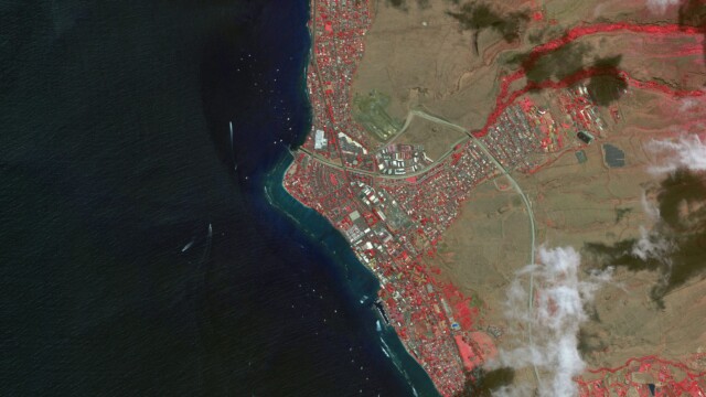


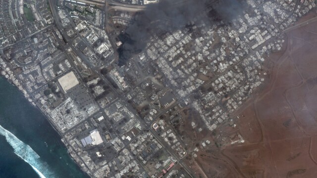
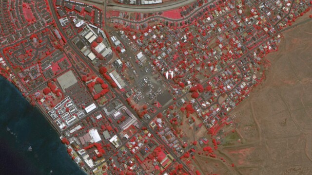
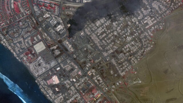
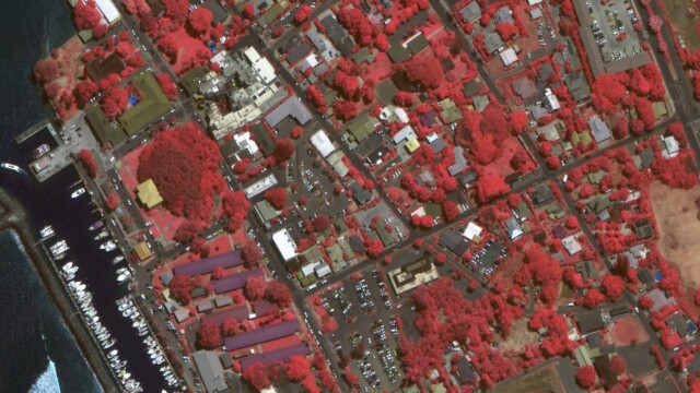
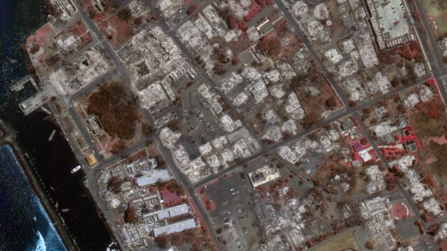
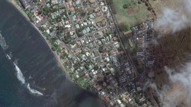
The satellite images provide a powerful visual reminder of the destruction caused by the wildfires. They also show the importance of satellite imagery in disaster response and recovery. Satellite imagery can be used to assess the damage, track the spread of the fires, and help to coordinate the relief effort.
The images above show a stark contrast between the area before and after the fires. In the before images, Lahaina is a lush, green town with a vibrant downtown area. In the after images, the town is a charred wasteland. Buildings have been reduced to rubble, and trees have been stripped of their leaves.
The false-colour infrared images provide even more detail about the extent of the damage. In these images, burned areas appear in black or grey, while healthy vegetation appears in shades of red. The images show that the fires have burned a vast area of land, including forests, residential areas, and businesses.
ALSO READ: In Photos: Satellite Images Capture Wildfire in Greece


