The Architectural Engineering and Construction (AEC) Industry is often called the barometer of any country’s progress. The industry greatly impacts communities across the UK and has the same potential to provide large numbers of high-skilled, well-paid jobs. And to encash the opportunities and address the challenges of the future UK is transforming the industry by increasing the use of geospatial technologies in various construction and infrastructure projects. Effective use of geospatial technologies aids in improved planning and design, making projects more sustainable, durable, and cost-effective in the long run.
EDF, a British energy company, has used enterprise GIS from Esri UK to create a geospatial portal for the Hinkley Point C (HPC) nuclear power station, one of Europe’s largest and most complex construction projects. Supporting better collaboration and enabling new digital workflows, the portal shares a single view of the entire project, helping employees and contractors work seamlessly and improve safety and productivity. Recently opened up to include Tier 1 contractors when construction of the nuclear reactors started, the portal has over 1,500 users and growing.
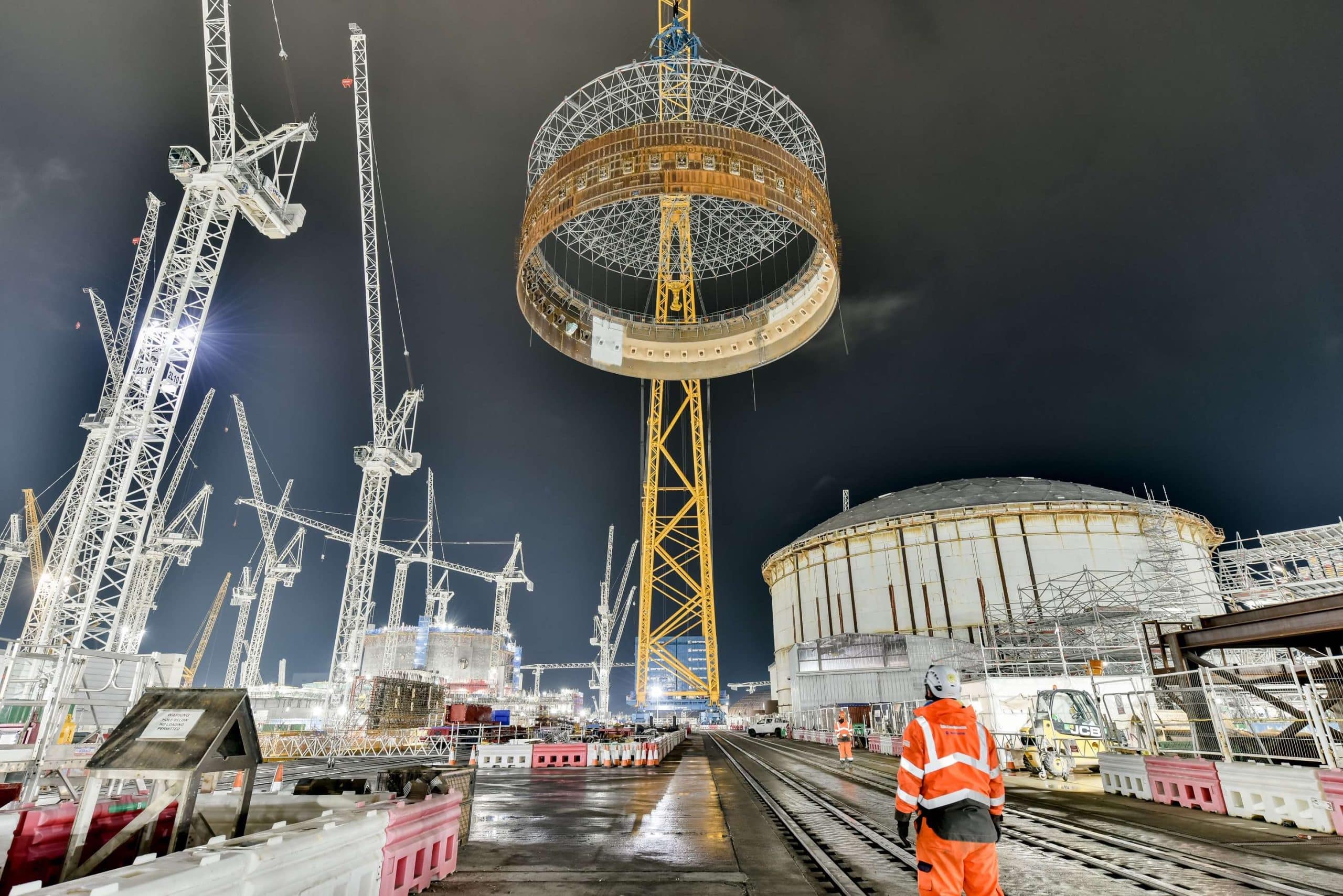
Currently one of Europe’s largest construction projects with 8,000 workers on the 450-acre site, Hinkley Point C is the UK’s first new nuclear power station built since Sizewell B in 1995. The nationally significant infrastructure will provide around 7% of the UK’s electricity, power around 6 million homes, and contribute to the UK Government’s Net Zero target.
Central source of data
Delivering clarity of information, the GIS portal is a central source of all spatial data, maps, apps, and dashboards, combining multiple sources of information and making them accessible to everyone on site. An interactive primary site map contains over 100 different data layers, from BIM models and CAD data, including Revit models, to construction operations, temporary works, utilities, logistics, and emergency preparedness.
“The scale of the project presents a complex logistical challenge,” said Jon Dolphin, Construction Project Manager and GIS Lead at HPC. “Clarity of construction data is critical, and the GIS portal provides a single view of this, which drives collaboration as people can see where things are happening and when. Every employee or contractor is making decisions based on the same data. The confidence this generates makes decision-making faster and strengthens the ability of teams to work more efficiently. As a result, we’ve seen improvements in quality, safety, and productivity.”

Starting life as a proof of concept three years ago, the GIS portal first became an enterprise roll-out in spring 2021 and has grown since then. “Small pilots showed what was possible, helping a wider audience understand the benefits of using GIS on a megaproject,” explained Dolphin. “Users now browse the spatial data, explore applications and enable new digital workflows relevant to them. The number of portal users is growing daily as more people become aware of what GIS has to offer and more use cases emerge.”
Digitizing workflows
Esri GIS has enhanced HPC’s ability to collect data out in the field, replacing manual methods using paper checklists, clipboards, and spreadsheets. One example is emergency planning data, used to provide assurance for regulatory purposes, which is now collected on tablets and appears in real-time in the GIS portal. Managers view and report on it using dashboards, helping to make more informed decisions.
Temporary Works teams use similar new digital workflows for planning and inspecting hundreds of simultaneous works, including excavations, earthworks, scaffolding, ramps, or formwork for reinforced concrete pours. Adding the spatial context means contractor activities do not clash, while physical surveys now take a fraction of the time. Using GIS apps and integrated dashboards for data input and reporting eliminates the need to transfer information into a report when the staff returns to the desktop.
Mobile GIS
Another example of mobile GIS in action is an app created to improve the management of generator permit requests. HPC needed to monitor emissions as the site grew and wanted a detailed understanding of generator use. Now contractors have the ability to use a new mobile app instead of a spreadsheet, to click on a location and request a generator which is submitted into a workflow for approval. A dashboard displays the data so electrical and environmental teams can optimize the use of generators and reduce emissions across the site. “The new digital approach has replaced the previous spreadsheet-based system, which lacked audibility and had no spatial context,” said Dolphin.
The portal will see another increase in usage when the MEH phase (Mechanical, Electrical and HVAC) ramps up in 2023 to manage to permit and control what is being built on-site. This phase will see contractors work together on the complex installation of cabling, pipework, and equipment for the power station’s 2,500 rooms.
Future plans include using GIS to track and optimize the use of plants around the site to reduce emissions and make transport services more intelligent by tracking the site’s buses and other vehicles.
“Having one GIS portal for our construction data is immensely powerful for breaking down communication barriers, getting everyone on the same page, and improving collaboration,” concluded Dolphin. “The use of Esri GIS at Hinkley Point C was a cultural shift for many people, but new digital approaches soon become indispensable when working on such complex engineering projects.”