

Home 2024 August 5

Daily Archives: 08/05/2024

Developing an Effective Space Strategy for India’s Defence

Developing an Effective Space Strategy for India’s Defence

In an exclusive interview, Dr Nithiyanandam, Head of the Takshashila Institution’s Geospatial Research Program discusses India’s unique approach to military space development and the increasing importance of geospatial in defence.

Considering the need for interoperability between the army, navy, air force, and space organisations, how can India develop an effective space strategy?

There is a need to maximize the use of space-based resources, focusing particularly on downstream applications, including optimising requirements through defence challenges. Ideally, sharing raw data from a central source could be beneficial, particularly when multiple services have diverse applications that rely on specific electromagnetic spectrums.

For instance, one scientist might utilize the spectrum to analyse changes in vegetation on land, while another scientist could apply it to study water bodies. It depends on different scientist’s interpretation of satellite images for different purposes.

As the threat from land, water, and air increases, the monitoring and mapping of sea and land do not belong to just one service.

What role can India’s private sector play in advancing the military space program and bolstering the nation’s space capabilities?

The focus of the Indian Private Sector currently is on expanding our remote sensing capabilities regarding launches, constellations, and building larger satellites. There is less emphasis on scientific research and exploring new frontiers as there is no incentive or business opportunity currently to invest time and money in these areas.

There is a need to innovate and push to new arenas of space-based applications in dual-use technology applications in the civilian domain.

We’re seeing rapid advancements in AI and ML. In what way can emerging tech like this be used in national security?

Technology is growing at a rapid pace in India and should be Used to improve our efforts and increase our preparedness, surveillance, and counteraction against possible threats. For effective utilisation, we need to clearly understand the technology and apply it at the right time for the correct application.

This means that not all applications require AI and ML for information extraction instead simple digital image processing and classical numerical modelling techniques may provide the necessary output. This prevents the demand for AI and ML in every software solution.

How can geospatial technologies effectively integrate into existing military and intelligence frameworks to understand national security risks?

There is a need to sensitize and build capacity with different agencies and primarily stakeholders who are components of the national security framework including state police and border security forces. This will bring awareness on new applications of geospatial technologies for the workforce in the national security domain.

The tool can also help in reducing the workforce and money we are spending at present. Secondly, geospatial technology has different vital components, not just maps. The opportunity for defence personnel to learn a broad spectrum of geospatial technology is limited, as teaching in traditional setups still focuses on image interpretation of maps and cartography.

Thirdly, Geospatial technology is a matter of “thinking spatially,” and not just the data and computing facility. There should be a careful appreciation and utilisation of the open-source information available in the domain.
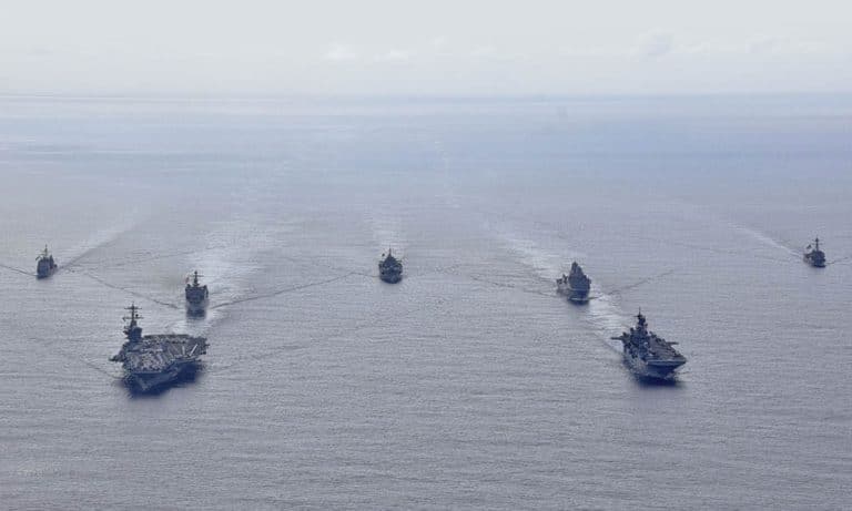
Revolutionizing Multi-Domain Security in Indo-Pacific

Revolutionizing Multi-Domain Security in Indo-Pacific

The intersection of geospatial and digital twin is key for exploring benefits and challenges in the context of multi-domain regional security.

In the ever-evolving landscape of global security, the Indo-Pacific region is at the forefront of technological innovation and strategic competition. The convergence of geospatial intelligence and digital twins is transforming the way nations approach regional security, enabling more effective decision-making, enhanced situational awareness, and improved operational efficiency.

The Role of Geospatial Intelligence

Geospatial Intelligence (GEOINT) has become a critical component of modern military operations, providing valuable insights into the physical environment and enabling informed decision-making.

The Indo-Pacific region is home to some of the world’s most complex and dynamic environments, from the densely populated cities of Southeast Asia to the remote and rugged terrain of the Himalayas. GEOINT plays a vital role in understanding these environments, enabling military forces to anticipate and respond to emerging threats.

According to Dr. John Smith, Director of the US Air Force’s GEOINT Program, “Geospatial intelligence is the foundation of modern military operations. It provides the situational awareness and context necessary for effective decision-making, allowing military forces to operate more efficiently and effectively in complex environments.”

Digital Twins: A New Era in Warfighting

Digital twins are virtual replicas of real-world objects or systems that mimic their behaviour and performance in a simulated environment. These digital models are created by integrating data from various sources, such as sensors, cameras, and other devices, to provide a comprehensive view of the system or object being modelled.

Digital twins can be used to simulate various scenarios, predict outcomes, and optimize performance, making them an invaluable tool for military operations.

The US Navy has been at the forefront of leveraging digital twins for warfighting, developing a comprehensive digital twin for its naval vessels. This digital twin simulates the performance of ships in various scenarios, such as combat operations, disaster response, and routine maintenance.

According to Rear Admiral Michael Brown, Commander of the US Navy’s Digital Twin Program, “Digital twins have revolutionized the way we train and operate our naval vessels. They provide real-time data and insights that enable our personnel to make informed decisions and optimize operations.”

Applications in Multi-Domain Regional Security

Digital twins have numerous applications in multi-domain regional security, from optimizing supply chain management to enhancing training and simulation. In the Indo-Pacific, digital twins can be used to simulate various scenarios, such as naval operations in the South China Sea or air operations in the skies above the Korean Peninsula.

According to Dr. Jane Doe, Director of the US Air Force’s Digital Twin Program, “Digital twins can be used to simulate complex scenarios, allowing military personnel to train and practice in a realistic and immersive environment. This enhances their readiness and responsiveness, enabling them to operate more effectively in the face of emerging threats.”

Challenges and Considerations

While digital twins offer numerous benefits, there are also challenges and considerations involved in their adoption. One of the primary concerns is data integration and interoperability, as digital twins rely on vast amounts of data from various sources.

According to Dr. John Smith, “Digital twins require robust cybersecurity measures to protect sensitive data and prevent unauthorized access.” Another challenge is the cost and complexity associated with developing and implementing digital twins.

According to Rear Admiral Michael Brown, “Developing and implementing digital twins requires significant investment in hardware, software, and personnel. However, the benefits they offer make them an invaluable tool for military operations.”

Future Trends and Opportunities

As digital twins continue to evolve and mature, we can expect to see even more innovative applications in multi-domain regional security. One exciting trend is the integration of artificial intelligence and machine learning into digital twins, enabling them to learn and adapt over time.

By leveraging these technologies, digital twins can become more accurate, responsive, and capable of predicting and preventing potential issues. According to Dr. Jane Doe, “The integration of AI and ML into digital twins will revolutionize the way we approach warfighting. It will enable us to anticipate and respond to emerging threats more effectively, and to optimize operations in real-time.”

Conclusion

In conclusion, the convergence of geospatial intelligence and digital twins is transforming the way nations approach multi-domain regional security in the Indo-Pacific. These technologies offer numerous benefits, from enhanced situational awareness to improved operational efficiency.

While there are challenges and considerations involved in their adoption, the benefits they offer make them an invaluable tool for military operations. As Dr. John Smith aptly states, “Geospatial intelligence and digital twins are the future of warfighting. They will enable military forces to operate more effectively and efficiently, and to stay ahead of the curve in an increasingly complex and dynamic environment.”

Nissan Partners with Acciona to Bring Silence Nanocars to UK

0
Nissan Partners with Acciona to Bring Silence Nanocars to UK

Nissan has confirmed as being the UK distributor of its partnership with ACCIONA’s car manufacturer SilenceOpens in a new tab. – a leading European brand of electric micro-mobility vehicles designed for cleaner, smarter, more flexible city living.

Under this partnership, Nissan will hold distribution and service rights in the UK from October 2024 for the Silence product range, including Silence S04 quadricycle vehicles and electric motorcycles.

Through this collaboration, Nissan customers will be able to access a range of uniquely designed and engineered Silence products, starting with the popular S04 NanocarOpens in a new tab.. Engineered for agility in bustling city environments, this compact, lightweight electric vehicle (EV) comes in two variants, the L6e and L7e, tailored to meet urban driving needs of all kinds.

Each variant boasts a strong electric-powered range, from 92 miles (L7e) to 109 miles (L6e), with top speeds reaching 28mph (L6e) and 54mph (L7e) – ideal for daily commutes or exploring the town. Powered by two 5.6kWh batteries, it offers quick, simple, convenient charging options, including direct charging, battery swapping at dedicated stations (available with subscription where available), and home or office charging through a removable battery pack.

Gareth Dunsmore, Managing Director of e-Micro Mobility at Nissan AMIEO (Africa, Middle East, India, Europe & Oceania), said: “Following Italy, France and Germany, I am excited to see our partnership now expanding to the UK. Through this Nissan partnership with ACCIONA, we’re ensuring that many more people across Europe have access to electric mobility and can embark on their EV journey. By opening access to Silence’s diverse range of alternative products, we are easing the EV transition by combining clean mobility with cutting-edge technology, in functional and flexible vehicles.”

This partnership comes hot on the heels of Nissan’s recent launch of The Arc – its new business plan focused strongly on driving value and strengthening competitiveness. Along with the launch of 11 bold new models to supercharge sales in the region, at the heart of The Arc is the strategic use of partnerships to drive business growth and transformation, hand-in-hand with like-minded organisations.

Smart, forward-looking collaborations with innovative companies such as Silence showcase this strategy perfectly, seamlessly aligning with Nissan’s goals to explore new revenue streams, accelerate the transition to EVs, and respond to the diverse and changing needs of Nissan customers today and tomorrow.

Crucially, this partnership reinforces Nissan’s commitment to a sustainable future, and its ambition to help create a cleaner, safer, and more inclusive world. By giving customers across Europe access to new mobility solutions, offering greater diversity of choice, and expanding into new territory, Nissan is lowering the barrier to entry for those who want to go electric – ensuring the transition to electric mobility is inclusive and accessible for all.

Carlos Sotelo, CEO of ACCIONA’s mobility business and Silence, shares the excitement, stating: “The needs of drivers in today’s towns and cities are changing – their commute, their attitudes to mobility, and what constitutes a realistic and efficient way for them to get around urban areas. To respond to this, we need to think smarter, smaller and lighter. Silence’s light electric vehicles (EV), partnered with Nissan’s strong distribution network, offer new, exciting, and clever options for urban mobility in Europe, shaping a more sustainable future.”

Offering both compact electric driving, and smart connectivity, the S04 Nanocar also comes equipped with the My Silence app – a one-stop-shop for any owner’s needs at the touch of a button. Through the app, customers have access to a range of cutting-edge digital services, including keyless entry, location tracking, monitoring of range and battery charge status. Taking flexible city mobility to new levels, it also allows customers to connect with friends and share access to their vehicle, without the need for swapping keys – pushing accessibility to EV options even further.